Drone technology helps farmers to build up continuous and timely land management. There is a published article describing the new way for precision agriculture. At Drone Dynamics, we use Pix4Dmapper to produce index map like NDVIs, DVIs, SAVI and many more. All of these are here to help planters in the world with more precise control to […]
GIS Application Explained
Here is a webinar presented by Jarlath O’Neil-Dunne of the UVM Spatial Analysis Lab. In this webinar, an extensive discussion is given, describing how GIS applications can be established rapidly in combination of UAV technology. Some key notes will be addressed below. A GIS application workflow consists of three steps: Data Acquisition Make products Decision making by utilizing the products […]
NDVI – Normalized Difference Vegetation Index Explained
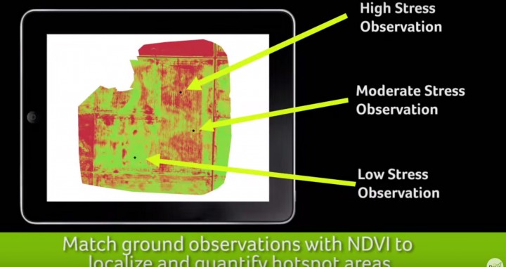
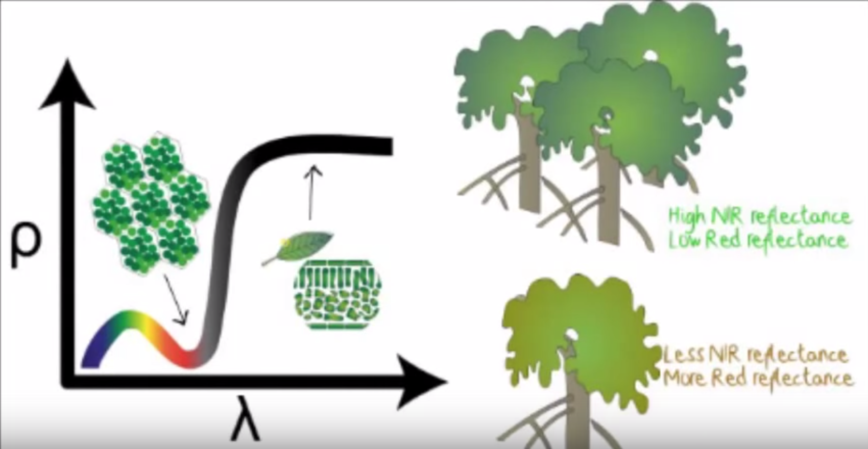
NDVI stands for Normalized Difference Vegetation Index which is an important parameter indicating the healthiness of vegetation. By using near-infrared imagery technology, a NDVI map can be drawn to reflect plant vigour in one area. A planter can then decide which actions to take in response to the NDVI result. Traditional sources of NDVI map include images from satellites […]
Precision Agriculture Explained
Here is a good video example which explains how drones can assist agriculture. A comparison between traditional and precision agriculture is gave in this video. This is what Drone Dynamics wants to achieve and provide! Check it out!