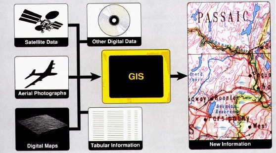
A Geographic Information System (GIS) is a system used for capturing, storing, manipulating, querying, analyzing and displaying geographically-referenced data
A Geographic Information System (GIS) is a system used for capturing, storing, manipulating, querying, analyzing and displaying geographically-referenced data