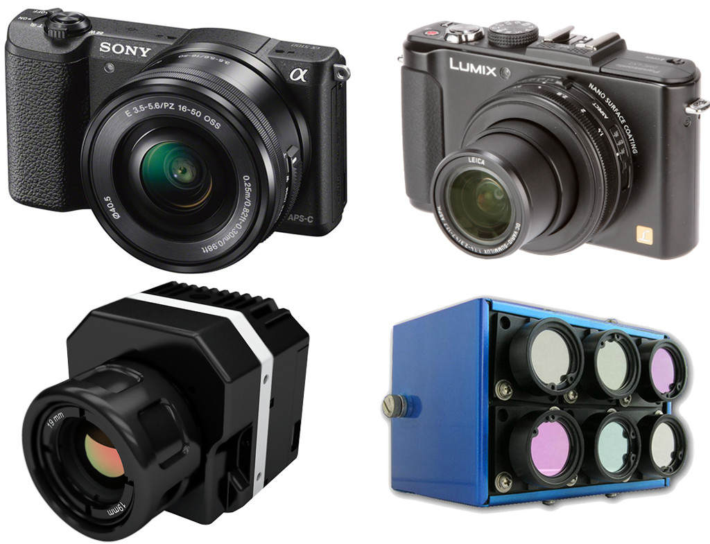
One primary usage of UAV is to collect high quality imageries, both visible and invisible, in order to obtain a higher level of detail. This data can then be further processed to make good business decisions, detect trends and predict future changes or potential issues that might arise. The imagery sensors used in UAV field can be categorized by light […]
Tag Archives: NVDI
Precision Agriculture with Pix4Dmapper
Drone technology helps farmers to build up continuous and timely land management. There is a published article describing the new way for precision agriculture. At Drone Dynamics, we use Pix4Dmapper to produce index map like NDVIs, DVIs, SAVI and many more. All of these are here to help planters in the world with more precise control to […]
NDVI – Normalized Difference Vegetation Index Explained
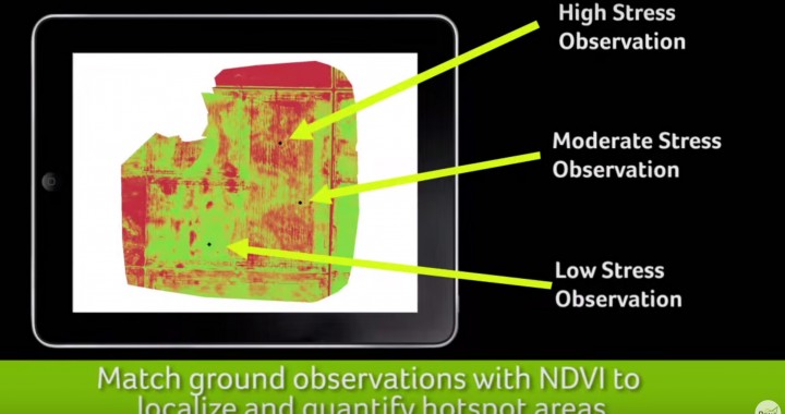
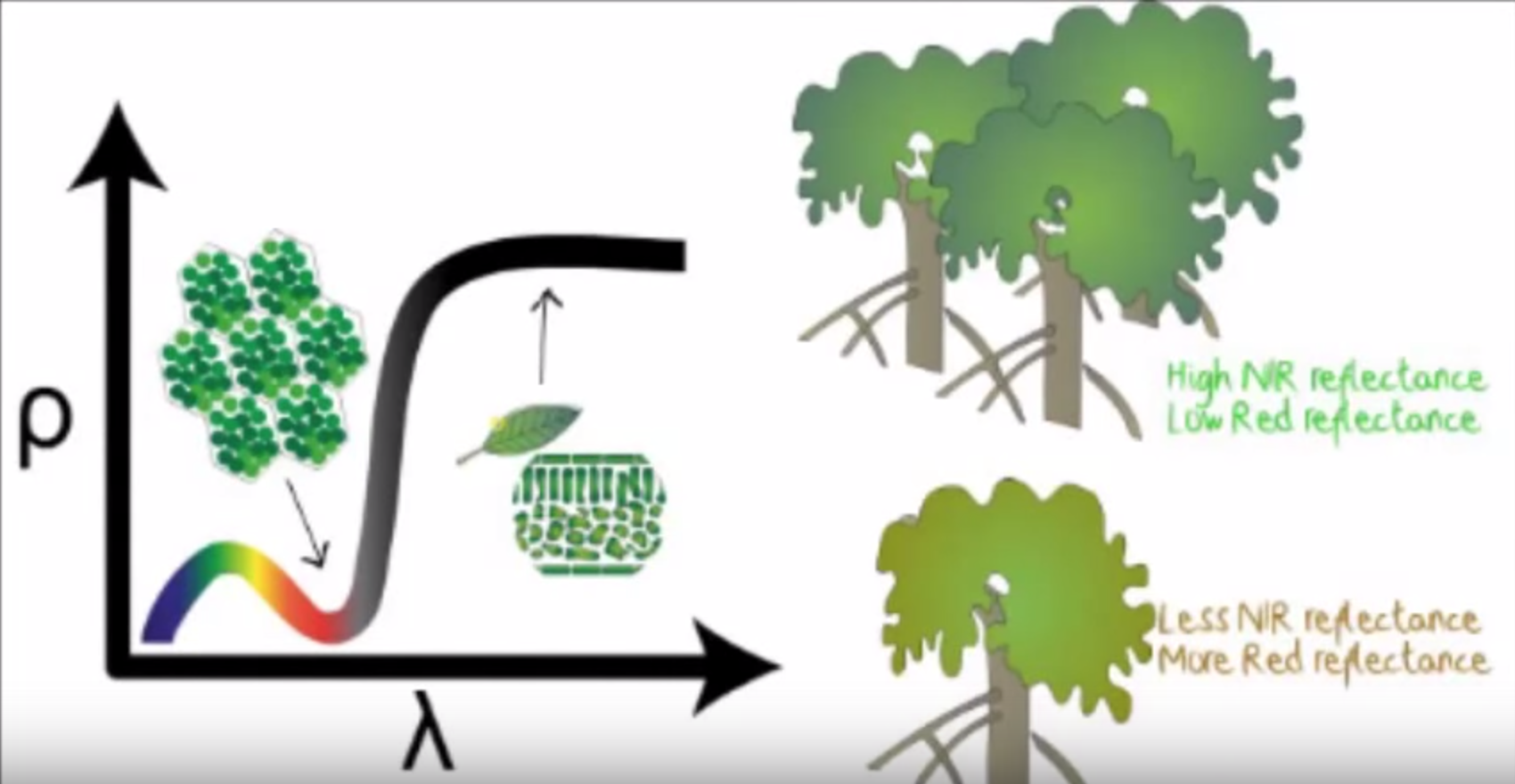
NDVI stands for Normalized Difference Vegetation Index which is an important parameter indicating the healthiness of vegetation. By using near-infrared imagery technology, a NDVI map can be drawn to reflect plant vigour in one area. A planter can then decide which actions to take in response to the NDVI result. Traditional sources of NDVI map include images from satellites […]