Drone Dynamics Logo
UAV, one promise for delivering
  • Home
  • News
  • Products
    • Sentinel X6 Pro
    • Sentinel X6-Plus II
    • Sentinel X4-Plus Recon
    • Eliminator 30
  • About
  • Contact
  • Menu

What is GIS – GIS Explained | NorthernGIS

Posted on August 30, 2015September 29, 2015 by Drone Dynamics Press

A Geographic Information System (GIS) is a system used for capturing, storing, manipulating, querying, analyzing and displaying geographically-referenced data
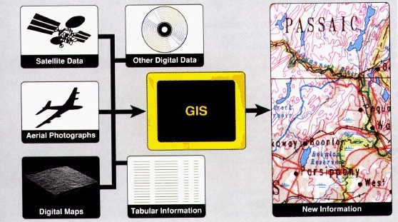
Source: What is GIS – GIS Explained | NorthernGIS

Posted in GIS and tagged GIS.

Post navigation

← Beyond military drones – the…
UAV Sensor Solutions →

Recent Posts

  • How thermal imaging can be used
  • Great Brook UAS Storm Damage July 21, 2015
  • UAV Sensor Solutions
  • What is GIS – GIS Explained | NorthernGIS
  • Beyond military drones – the future of unmanned flight
  • Precision Agriculture with Pix4Dmapper
  • GIS Application Explained

Trademark

All brand names, logos, and trade marks belong to their respective owners.

Social Links

Facebook
YouTube
© 2025 Drone Dynamics