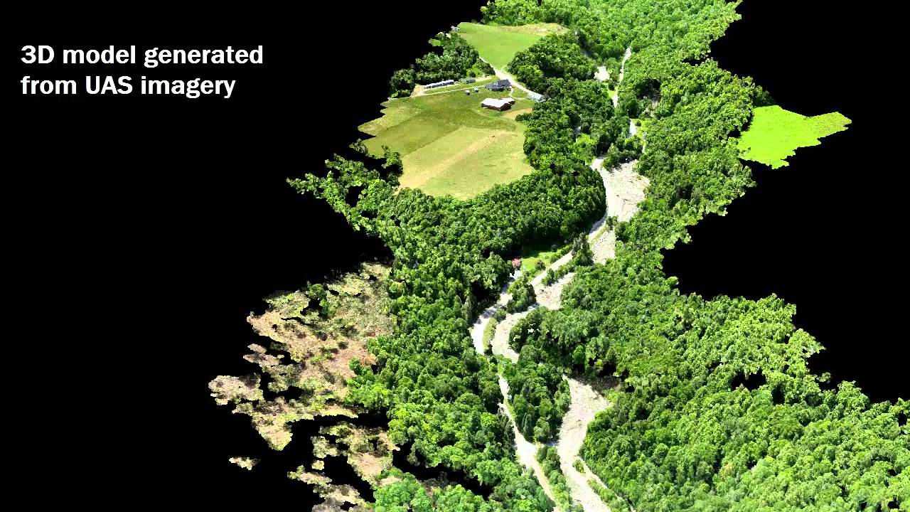
Severe thunderstorms hit Central Vermont on July 19, 2015 causing flash flooding on the Great Brook. The floods and associated debris causes major damage to the transportation network. On July 21st the University of Vermont’s UAS team deployed to Plainfield, VT to map the damage and the changes that have occurred in the Great Brook.
Tag Archives: GIS
UAV Sensor Solutions
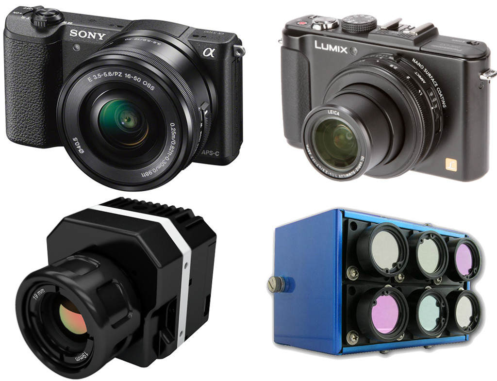
One primary usage of UAV is to collect high quality imageries, both visible and invisible, in order to obtain a higher level of detail. This data can then be further processed to make good business decisions, detect trends and predict future changes or potential issues that might arise. The imagery sensors used in UAV field can be categorized by light […]
What is GIS – GIS Explained | NorthernGIS
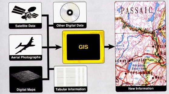
A Geographic Information System (GIS) is a system used for capturing, storing, manipulating, querying, analyzing and displaying geographically-referenced data Source: What is GIS – GIS Explained | NorthernGIS
GIS Application Explained
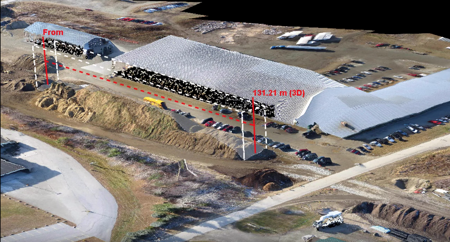
Here is a webinar presented by Jarlath O’Neil-Dunne of the UVM Spatial Analysis Lab. In this webinar, an extensive discussion is given, describing how GIS applications can be established rapidly in combination of UAV technology. Some key notes will be addressed below. A GIS application workflow consists of three steps: Data Acquisition Make products Decision making by utilizing the products […]